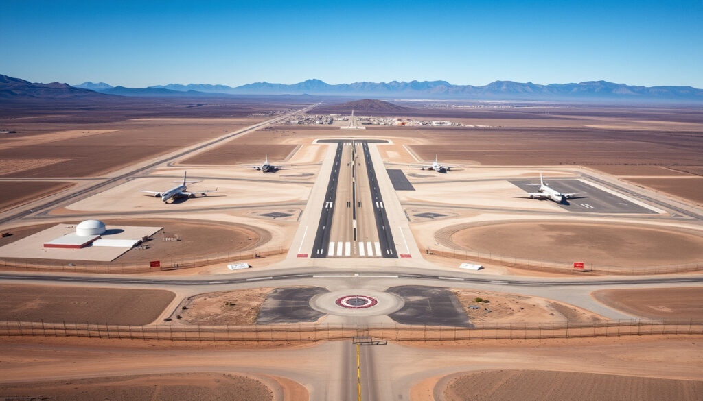
Where Is Area 51 – Exact Coordinates, Maps and Restrictions
Area 51 is one of the most enduring symbols of military secrecy in the United States. This remote facility, tucked into the Nevada desert, has fueled decades of speculation and conspiracy theories. Despite its fame in popular culture, the exact details of its operations remain classified. Understanding where it is located, how to find it, and what restrictions govern access requires a careful look at publicly available information and declassified documents.
The facility operates as part of the Nevada Test and Training Range, administered by Edwards Air Force Base in California. Its precise coordinates have been verified through multiple mapping sources, though official confirmation from the U.S. government remained limited until recent years. This guide breaks down everything known about its location, surrounding geography, and the rules that govern public interaction with the site.
Where Exactly Is Area 51 Located?
Area 51 sits at the center of Groom Lake, a dry salt flat in Lincoln County, southern Nevada. The site occupies the Groom Lake Valley portion of the Tonopah Basin, approximately 25 miles south of the town of Rachel. The facility rests at an elevation of roughly 4,409 feet above sea level.
Lincoln County, Nevada (Groom Lake)
37.2431° N, 115.7930° W
U.S. Air Force
~83 miles (134 km) north-northwest
GPS Coordinates and Mapping Details
The most widely cited GPS coordinates for Area 51 are 37.2431°N, 115.7930°W. Minor variations appear across different sources, including 37°14′0″N 115°48′30″W and 37.272011, -115.815498. The original rectangular base spans roughly 6 by 10 miles, though the surrounding restricted airspace zone, known as the “Groom Box,” extends much further.
Interactive maps available through geographic information platforms detail the site’s runways, perimeter fencing, and boundary markers. The Groom Box itself covers approximately 23 by 25 miles, translating to 575 square miles of restricted airspace designated as R-4808N. Satellite imagery confirms the distinctive dry lakebed surface and supporting infrastructure, though details within the innermost zones remain blurred on public mapping services.
Official Names and Designations
The CIA officially refers to the facility as Homey Airport (ICAO code: KXTA, FAA code: XTA). Alternative names include Dreamland, Paradise Ranch, and Zone 51. The name “Area 51” itself originated from atomic testing mapping conventions used during the mid-20th century and first appeared publicly in a CIA Vietnam War document.
The original designation “Paradise Ranch” was chosen to make the remote posting more appealing to pilots being recruited for early operations. The connection to Nevada’s nuclear testing history remains significant, as the facility borders Yucca Flat, the site of 739 nuclear tests conducted by the United States.
The facility operates under the official designation Homey Airport (KXTA/XTA) while appearing on FAA charts as part of Restricted Area 4808 North. Google Maps searches for “Area 51” or “Groom Lake” display the broader Groom Box but restrict detailed imagery within the most sensitive zones.
Geographic Context and Surrounding Terrain
Groom Lake sits within a basin surrounded by the Jumbled Hills to the northeast and the Pahute Mesa to the west. The terrain consists primarily of hard-packed alkali flats characteristic of endorheic basins in the Great Basin region. Access from the south travels through Tikaboo Valley before reaching State Route 375, Nevada’s so-called “Extraterrestrial Highway.”
The facility connects to external road networks via Groom Lake Road, which leads northeast through the Jumbled Hills to State Route 375. This highway provides the only public route approaching the restricted zone. The road passes through a security checkpoint before entering the outermost boundaries of the Groom Box.
How Far Is Area 51 from Las Vegas and Major Cities?
The most frequently asked question about visiting Area 51 involves its distance from Las Vegas, the nearest major metropolitan area. The facility lies approximately 83 miles (134 km) north-northwest of Las Vegas, making it a roughly two-hour drive under normal conditions. However, reaching the actual restricted zone is not possible for members of the public.
Driving Routes and Road Conditions
No public roads lead directly to Area 51. The approach involves traveling north from Las Vegas on Interstate 95, then east on State Route 375 toward Rachel. Groom Lake Road branches from this highway, but a security checkpoint blocks further progress. The surrounding public lands offer views of the restricted airspace boundaries from designated overlooks.
State Route 375 earned its “Extraterrestrial Highway” nickname due to its proximity to Area 51 and the UFO-themed businesses that cater to curious travelers in Rachel. These establishments provide information about the site’s history and the culture surrounding military secrecy in Nevada’s desert regions. Those planning a visit to the broader region may find useful information about Indiana Dunes National Park and similar public lands, which offer comparable outdoor recreation experiences in comparable desert environments.
Viewing Locations and Legal Observational Points
While entry remains prohibited, legal viewing spots exist along public roadways outside the Groom Box boundaries. Tikaboo Peak offers elevated views of the valley, though distance and atmospheric conditions limit visible detail. The area along SR 375 near Rachel provides safer, more accessible observation points for those interested in the geographic context.
Public lands surrounding the restricted zone remain open for hiking, photography, and general exploration. Visitors should respect all posted boundaries and understand that aerial surveillance of the area is continuous. Drone operations near the site face significant legal restrictions under federal aviation regulations.
The nearest services, fuel, and accommodations are available in Alamo, approximately 70 miles south of Rachel, or in Tonopah to the west. Desert conditions require preparation, including adequate water supplies, vehicle maintenance, and awareness of restricted zone boundaries marked on published maps.
Can You Visit Area 51?
Direct access to Area 51 is not permitted under any circumstances. The facility remains an active U.S. Air Force installation administered by Edwards Air Force Base. It falls within Restricted Area 4808 North (R-4808N), encompassing both airspace and ground restrictions enforced by armed security personnel.
Legal Restrictions and Enforcement
Trespassing laws carry serious consequences within the restricted zone. The facility’s remote location does not diminish the intensity of security measures. Infrared sensors, motion detection equipment, and regular patrols monitor the perimeter continuously. Several individuals have faced legal action for attempting unauthorized entry over the decades.
The legal framework establishing restrictions combines federal aviation regulations for the no-fly zone with property ownership by the Department of Defense. Airspace above the Groom Box remains classified as restricted, with violations subject to interception by military aircraft. Ground violations fall under federal trespassing statutes with potential criminal penalties.
The “Storm Area 51” Phenomenon
Social media events organized under names like “Storm Area 51” demonstrated the tension between public curiosity and security protocols. The 2019 event, which went viral across multiple platforms, prompted official responses from military and law enforcement agencies. No significant breaches occurred, though the phenomenon highlighted the ongoing public interest in the facility’s existence and activities.
The event’s aftermath reinforced the seriousness with which authorities treat unauthorized attempts to access the facility. While the gathering attracted thousands of internet users initially, actual attendance remained minimal, and no incidents required significant law enforcement response.
Unauthorized entry into Area 51 or its surrounding restricted zones violates federal law. Visitors to Nevada should remain on public lands clearly marked outside Groom Box boundaries. Respecting these boundaries ensures both personal safety and compliance with applicable regulations.
What Is Area 51 Officially Used For?
Publicly available information confirms that Area 51 serves as a facility for testing and developing advanced aircraft and aerospace systems. The U.S. Air Force operates the site for classified testing and training purposes. Exact details regarding current projects remain protected under national security classifications.
Historical Programs and Declassified Activities
The existence of the facility remained officially unacknowledged until 2013, when the CIA declassified documents confirming its role in the U-2 spy plane program during the 1950s and 1960s. These documents revealed that the isolated desert location provided the secrecy necessary for testing aircraft designed to operate at extremely high altitudes while evading detection by adversary air defenses.
The U-2 program established the template for subsequent classified aviation projects conducted at the site. Following declassification, government sources acknowledged the facility’s role in “sensitive aircraft development programs” without specifying current or subsequent projects. The Air Force continues to describe operations using vague language such as “an operating location near Groom Dry Lake.”
Relationship to Broader Nevada Testing Infrastructure
Area 51 functions as part of a larger network of military and nuclear testing facilities within Nevada. The Nevada Test and Training Range encompasses multiple ranges used by all branches of the U.S. military for weapons testing, aerial combat training, and special operations exercises. The facility’s proximity to the Nevada National Security Site (formerly Nevada Test Site) reflects the historical connection between aerospace development and nuclear weapons programs.
Yucca Mountain, located near the facility, has been the subject of extensive controversy regarding its proposed use as a nuclear waste repository. The connection highlights the concentration of sensitive government activities within Lincoln County and the surrounding desert regions. Travelers interested in exploring the history of classified military operations in the American West may find relevant context in articles about Las Vegas and its role as a gateway to Nevada’s military testing grounds.
Timeline of Area 51’s History
The facility’s history spans nearly seven decades, with significant milestones marking the evolution of public knowledge and official acknowledgment.
- 1955 – The CIA and U.S. Air Force establish Groom Lake as a remote testing site, selecting the location for its isolation and favorable flying conditions.
- 1956–1970s – The U-2 spy plane program conducts classified flights from the facility, gathering intelligence on Soviet and other targets during the Cold War.
- 1970s–1980s – Additional classified programs, including later reconnaissance and stealth aircraft development, reportedly utilize the facility.
- 1989 – Former Lockheed employee Robert Lazar publicly identifies the site and claims involvement with reverse-engineering extraterrestrial technology, bringing widespread attention to Area 51.
- 1990s – Media and public interest in the facility intensifies, with numerous documentaries and investigative reports exploring its purpose and activities.
- 2013 – The CIA officially declassifies the existence of Area 51 and confirms its role in the U-2 program through historical document releases.
- 2019 – The “Storm Area 51” social media phenomenon draws millions of participants and prompts official military warnings about trespassing.
What We Know Versus What Remains Uncertain
Confirmed Information
- Area 51 is an active U.S. Air Force facility at Groom Lake, Nevada
- Coordinates: 37.2431°N, 115.7930°W
- The facility was established in 1955 for classified aircraft testing
- CIA officially acknowledged the site in 2013, confirming U-2 program involvement
- Access is restricted; no public entry is permitted
- The site falls under Restricted Area 4808 North (R-4808N)
- It is administered by Edwards Air Force Base
Information That Remains Unclear
- Specific current projects and aircraft under development
- Exact organizational structure and personnel levels
- Details regarding reported sightings of experimental aircraft
- Nature of any recovered materials or artifacts
- Full scope of historical programs beyond U-2
- Future plans for the facility’s continued operation
- Potential for additional future declassifications
Understanding the Significance of Area 51
The existence of Area 51 represents a fundamental tension in democratic societies between transparency and national security. The facility’s isolation in the Nevada desert made it ideal for testing technologies whose capabilities needed protection from potential adversaries. The classification surrounding the site persists because the types of systems developed there may remain operationally relevant.
The public fascination with Area 51 extends beyond idle curiosity. The facility symbolizes the government’s capacity to maintain secrecy even within an era of satellite imagery and digital information. The contrast between what is visible on maps and what remains classified creates fertile ground for speculation and theories about extraterrestrial involvement.
For those interested in the broader context of military aviation and aerospace development, the facility’s history offers insight into how advanced technologies transition from classified programs to public knowledge. The U-2 aircraft, once a closely guarded secret, now operates in modified forms as NASA science platforms, illustrating the eventual arc from mystery to mainstream understanding.
Primary Sources and Official Documentation
“This facility is an operating location near Groom Dry Lake.”
— U.S. Air Force public affairs statement
“The United States government can confirm the existence of the facility known as Area 51… it played a critical role in the development of the U-2 spy plane.”
— CIA declassified document, 2013
Official information remains limited primarily to historical acknowledgments and regulatory filings. The CIA maintains a collection of Area 51-related documents in its public reading room. FAA charts designate the airspace restrictions surrounding the facility, and Air Force fact sheets acknowledge its connection to Nellis Air Force Base operations.
Summary
Area 51 occupies a unique position at the intersection of military secrecy, aviation history, and popular culture. Located at Groom Lake in Lincoln County, Nevada, the facility sits approximately 83 miles from Las Vegas, surrounded by restricted airspace designated R-4808N. Its coordinates (37.2431°N, 115.7930°W) appear across multiple mapping services, though details within the most sensitive zones remain obscured on public platforms.
Public access is prohibited, and legal viewing is limited to designated areas along State Route 375 near Rachel and elevated positions outside the Groom Box boundaries. The facility’s official purpose involves classified aircraft testing, with confirmed historical involvement in the U-2 spy plane program. Information regarding current activities remains protected by national security classifications. Travelers interested in the region’s geography and history can explore similar public lands as alternative destinations within Nevada’s extensive outdoor recreation network.
Frequently Asked Questions
Is Area 51 a real place?
Yes. Area 51 is a real, active U.S. Air Force facility located at Groom Lake in Nevada. Its existence was officially acknowledged by the CIA in 2013.
What are the GPS coordinates of Area 51?
The most widely accepted coordinates are 37.2431°N, 115.7930°W, though minor variations appear across different mapping sources.
How far is Area 51 from Las Vegas?
The facility lies approximately 83 miles (134 kilometers) north-northwest of Las Vegas, requiring roughly two hours of driving time to reach the vicinity.
Can you visit Area 51?
No. The facility is an active military installation with no public access. Unauthorized entry is prohibited by federal law and enforced by armed security personnel.
What is Area 51 used for?
The official purpose involves classified testing and development of aircraft and aerospace systems. Historical records confirm involvement in the U-2 spy plane program during the Cold War.
Why is Area 51 so secret?
The secrecy protects sensitive aerospace programs from potential adversaries. The classification allows the U.S. military to develop advanced capabilities without revealing specifications or vulnerabilities.
Can you see Area 51 on Google Maps?
Yes. Google Maps displays the broader Groom Box and the dry lakebed at Groom Lake, but detailed imagery within the restricted zone is blurred or limited.
What is the closest town to Area 51?
Rachel, Nevada, is the nearest community, located approximately 25 miles north of Groom Lake. The town has a population of roughly 50 residents and caters to visitors interested in the Area 51 phenomenon.
More related posts
 Watch Brewers vs. Dodgers: NLCS Game 3 live
 Disney Plus Hulu Bundle – Pricing Plans and Savings
 How Old Is Gordon Ramsay? Age, Family, Net Worth
 Check Your Dairy Queen Gift Card Balance
 Dorian Thompson-Robinson: Eagles waive QB, career stats
 Aladdin Ground Beef Recall: Key Facts and Aldi Confusion
 Best iPhone 17 Pro Cases 2025: Ireland’s Top Picks
 2025 401k Contribution Limit: $23,500 & Catch-Up Rules (IRS)